by Andrea Polcaro
Archaeoastronomy is a subsidiary science to Archaeology aiming at identifying astronomical connections of structures and artefacts of archaeological interest. The first studies designed to recognize the role of celestial phenomena in ancient civilizations were conducted with coherent and partially codified methods in the United Kingdom between the end of the 19th and the beginning of the 20th century and focused on the possible astronomical meaning of a number of archaeological sites in the British Islands. The archaeologist Sir William Matthew Flinders Petrie was the first to quantitatively study, in 1880, the famous megalithic monument of Stonehenge, by checking the presence of an astronomical alignment with the summer solstice sunrise.
Fourteen years later the astrophysicist Sir Norman Lockyer returned to the idea of astronomical orientations in ancient buildings. His studies on Egyptian pyramids and Stonehenge became a model of subsequent archaeoastronomical studies, while his book Surveying for Archaeologists (1909) established the basic principles for that part of Archaeoastronomy devoted to the detection of astronomical alignments. Other scholars produced significant results by applying Lockyer’s methods. These studies gave rise to many important research projects, concerning European prehistoric sites as well as important Egyptian, Mesopotamian and pre-Columbian monuments and sites, so that, in the middle of 20th century, it was widely agreed that astronomical orientation was an important component of the architectural solutions chosen by many cultures.
However, due to a large number of archaeoastronomical works conducted in the 1960s without taking into account the actual archaeological and historical contexts, Archaeoastronomy began to be perceived with suspicion and was then utterly rejected by a large number of archaeologists. An important role in the recovery of archaeoastronomical methods was played by the Royal Society, which in 1981 promoted the first Oxford International Conference on Archaeoastronomy, where the study of astronomical orientations of archaeological sites was one of the topics discussed. The Conferences are still today attended by humanities scholars, scientists and astronomers. Currently, major international (such as SEAC and ISAAC) and national scientific societies are devoted to Archaeoastronomy in past and present cultures. During the last decades, Archaeoastronomy has also witnessed significant development in Italy, due to the efforts of the Italian Archaeoastronomical Society (SIA), started in 2000 under the auspices of the Accademia Nazionale dei Lincei that in the 1990s organized three important conferences, playing a role similar to the one of the Royal Society.
Archaeoastronomical studies soon discovered that ancient builders gave to astronomical orientations a calendrical meaning, indicating an astronomical event important for the religious life of a community. After recognizing these orientations, it was essential to compare them with a reconstruction of the sky at the time in which the astronomically oriented monument was built. For this task it is necessary the use of planetarium software, capable of calculating the precession of the equinoxes and the other effects that modify the position of the celestial bodies in the sky.
The first archaeoastronomical studies employed commercial virtual planetarium software (such as “Starry Sky”) or specific software developed by several authors (such as “Stonehenge” of Gerald Stanley Hawkins). The problem of the former is that, being developed for the control of a telescope to date, they roughly correct the effects of the precession of the equinoxes and the other time-dependent astronomical effects are usually not taken into account.
From the 1990s, a number of astronomical software specialists used the same system to solve the problem: consider the NASA JPL ephemeris as data source, calculated by a super-computer and calibrated on the historical observations of the solar and lunar eclipse, then compute by interpolation the position of the astronomical objects and the aspect of the celestial vault at the desired date. These software have almost the same accuracy of the JPL ephemeris: they could thus be considered entirely reliable since the 7th century BCE, thanks to the calibration on the Babylonian astronomical compendia, losing their precision going back in time. The JPL ephemeris, and the software using them, are in any case sufficiently reliable at least till 3000 BCE for the position of the Sun and till the 1500 BCE for the position of the Moon and the planets.
The main software currently available are: Solex, created by Aldo Vitagliano of Naples University Federico II and Stellarium, developed by a large group of professionals in astronomic software, coordinated by Fabien Chéreau and then further improved, mainly by the group of Wien University coordinated by Georg Zotti. They are both open source and can be downloaded for free.
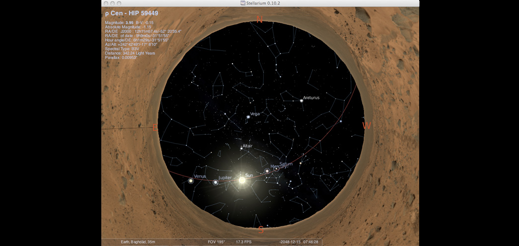
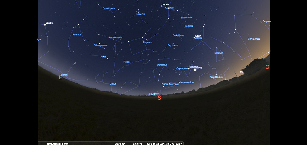
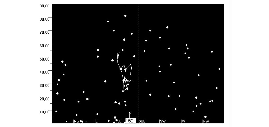
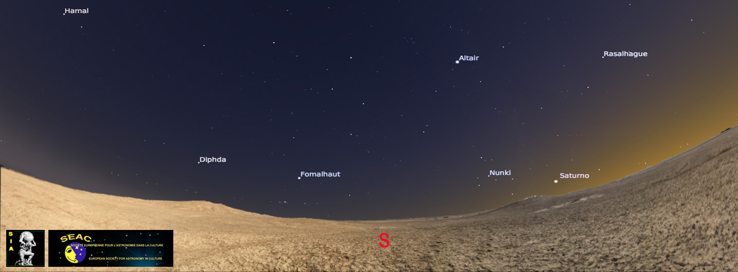
The two software have different purposes. Solex can manage large data files indicating the position of celestial bodies starting from a given date for long periods of time. These files, entered into a database, allow to search patterns and stars configurations unknown a priori. Stellarium allows the reconstruction of the sky at a requested date with an extremely realistic graphic, which gives the opportunity to include Digital Elevation Model of the landscape surrounding the monument or a real-life panorama from digital photos prepared by the users and thus verify particular lighting effects, hierophanies and alignments of any kind of structures. Its user friendly interface, gives the possibility to manage the observer view on the horizon, determining the rising and dawn points of stars and planets.
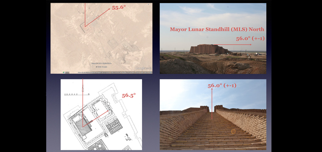
Archaeoastronomical studies also use many more tools developed for other purposes, such as Geographical Information Systems. The growing potential of Google Earth, a widespread on line freeware GIS with an easy interface, makes it increasingly attractive for archaeoastronomical studies, above all for calculating alignments with possible astronomical value in case of large buildings, clearly visible from satellite images. This technique is gaining ground for detecting structures located in hardly accessible areas or where a direct survey is difficult to organize.
VMAC – 2017